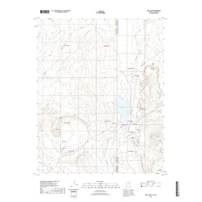
2018 Map of Buell Park
USGS Topo · Published 2018About this map
Red Lake and the surrounding Black Creek Valley dominate this high-desert landscape along the Arizona and New Mexico border. The settlement of Navajo serves as a modern hub, with residential streets like Lone Pine Dr and Shepard Spring Blvd clustered near the intersection of Indian Svc Rte 12. The terrain is defined by dramatic geologic formations, including the circular Buell Park depression and the towering Zilditloi Mtn, which rises toward the Chuska Mountains.
Find a feature on this map
46 named features on this map. Tap any name to fly to it.
Don’t see what you’re looking for? This feature index may not catch every label — zoom into the map to look around manually.
Map Details
Editions of this 2018 Buell Park Map
This is the sole edition of this map. No revisions or reprints were ever made.
Other maps of this area

1886 · Wingate
USGS Topo · 1:250,000

1886 · Fort Defiance
USGS Topo · 1:250,000

1889 · Chaco
USGS Topo · 1:250,000

1892 · Fort Defiance
USGS Topo · 1:250,000

1892 · Wingate
USGS Topo · 1:250,000

1892 · Chaco
USGS Topo · 1:250,000

1892 · Canyon De Chelly
USGS Topo · 1:250,000

1954 · Shiprock
USGS Topo · 1:250,000

1954 · Gallup
USGS Topo · 1:250,000

1955 · Zith-Tusayan Butte 1 SE
USGS Topo · 1:24,000