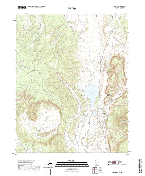
2021 Map of Buell Park
USGS Topo · Published 2021About this map
The high plateau country along the Arizona-New Mexico border is defined by the unique geological depression of Buell Park and the looming heights of Buell Mtn. This 2021 survey captures the settlement of Navajo, located at the southeastern edge of the quadrangle near the Chuska Mountains. The town's grid is detailed with residential streets like Walnut Ave and Poplar Ave, serving as a central hub in this corner of the Navajo Nation.
Find a feature on this map
47 named features on this map. Tap any name to fly to it.
Don’t see what you’re looking for? This feature index may not catch every label — zoom into the map to look around manually.
Map Details
Editions of this 2021 Buell Park Map
This is the sole edition of this map. No revisions or reprints were ever made.
Other maps of this area

1886 · Wingate
USGS Topo · 1:250,000

1886 · Fort Defiance
USGS Topo · 1:250,000

1889 · Chaco
USGS Topo · 1:250,000

1892 · Fort Defiance
USGS Topo · 1:250,000

1892 · Wingate
USGS Topo · 1:250,000

1892 · Chaco
USGS Topo · 1:250,000

1892 · Canyon De Chelly
USGS Topo · 1:250,000

1954 · Shiprock
USGS Topo · 1:250,000

1954 · Gallup
USGS Topo · 1:250,000

1955 · Zith-Tusayan Butte 1 SE
USGS Topo · 1:24,000