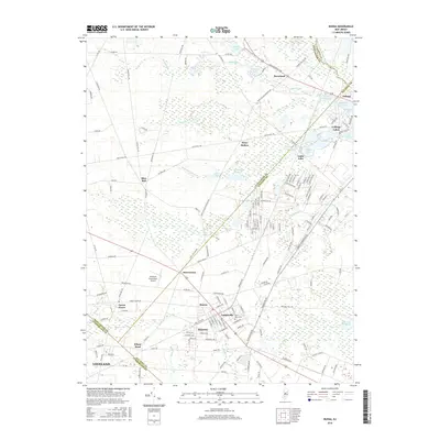
2016 Map of Buena
USGS Topo · Published 2016About this map
Landisville and Minotola anchor the southern portion of this landscape, where the local economy was historically defined by the intersection of rail and road. The northern reaches are characterized by a network of creeks and small lakes, including Cranes Lake and Diamond Lake, feeding into the Hospitality Br and White Oak Br. This area shows the distinct transition from the more developed settlements like Buena to the rural pockets of Berryland and Piney Hollow. A notable concentration of aviation and transportation infrastructure is evident with the Vineland-Downstown Airport situated near Downstown. Significant local history landmarks, such as Saint Marys Cem, serve as important touchstones for genealogical research in this multi-county border region where Gloucester, Atlantic, and Cumberland counties converge.
Find a feature on this map
166 named features on this map. Tap any name to fly to it.
Don’t see what you’re looking for? This feature index may not catch every label — zoom into the map to look around manually.
Map Details
Editions of this 2016 Buena Map
This is the sole edition of this map. No revisions or reprints were ever made.
Other maps of this area

1890 · Hammonton
USGS Topo · 1:62,500

1890 · Tuckahoe
USGS Topo · 1:62,500

1890 · Bridgeton
USGS Topo · 1:62,500

1890 · Glassboro
USGS Topo · 1:62,500

1893 · Tuckahoe
USGS Topo · 1:62,500

1894 · Hammonton
USGS Topo · 1:62,500

1894 · Bridgeton
USGS Topo · 1:62,500

1898 · Glassboro
USGS Topo · 1:62,500

1898 · Hammonton
USGS Topo · 1:62,500

1899 · Vineland
USGS Topo · 1:125,000