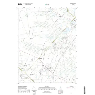
2019 Map of Buena
USGS Topo · Published 2019About this map
The Great Egg Harbor River flows through the northeast corner of this South Jersey landscape, anchoring a region defined by agricultural heritage and small-town junctions. At the heart of the map, the settlements of Buena, Landisville, and Minotola form a contiguous corridor of local industry and residence. To the south, the northern reaches of Vineland extend toward the Wheat Road community, while the Vineland-Downstown Airport and Saint Marys Cem serve as prominent local landmarks.
Find a feature on this map
167 named features on this map. Tap any name to fly to it.
Don’t see what you’re looking for? This feature index may not catch every label — zoom into the map to look around manually.
Map Details
Editions of this 2019 Buena Map
This is the sole edition of this map. No revisions or reprints were ever made.
Other maps of this area

1890 · Hammonton
USGS Topo · 1:62,500

1890 · Tuckahoe
USGS Topo · 1:62,500

1890 · Bridgeton
USGS Topo · 1:62,500

1890 · Glassboro
USGS Topo · 1:62,500

1893 · Tuckahoe
USGS Topo · 1:62,500

1894 · Hammonton
USGS Topo · 1:62,500

1894 · Bridgeton
USGS Topo · 1:62,500

1898 · Glassboro
USGS Topo · 1:62,500

1898 · Hammonton
USGS Topo · 1:62,500

1899 · Vineland
USGS Topo · 1:125,000