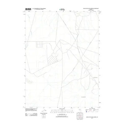
2011 Map of Buena Vista Hills North
USGS Topo · Published 2011About this map
Old Emigrant Trl and its modern successor, Old Emigrant Rd, trace a path through this section of Churchill County, following the historical migration routes that once brought travelers across the Nevada desert. The landscape is defined by the gradual slopes of the Buena Vista Hills and the prominent rising form of Chocolate Butte. This map captures the intersection of historical transit and mid-century desert infrastructure, where the Coal Canyon-Stillwater Rd cuts through the arid basin. Drainage patterns like Packard Wash provide a geographic blueprint of the watershed, showing how water moves through the high-desert terrain. For those interested in the physical legacy of early western travel, the clear delineation of the old trail against the contemporary road network illustrates how ancient routes continue to influence the modern desert map.
Find a feature on this map
6 named features on this map. Tap any name to fly to it.
Don’t see what you’re looking for? This feature index may not catch every label — zoom into the map to look around manually.
Map Details
Editions of this 2011 Buena Vista Hills North Map
This is the sole edition of this map. No revisions or reprints were ever made.
Other maps of this area

1908 · Carson Sink
USGS Topo · 1:250,000

1910 · Carson Sink
USGS Topo · 1:250,000

1931 · Lovelock
USGS Topo · 1:250,000

1935 · Lovelock
USGS Topo · 1:250,000

1954 · Buffalo Mtn
USGS Topo · 1:62,500

1955 · Lovelock
USGS Topo · 1:250,000

1956 · Lovelock
USGS Topo · 1:62,500

1957 · Reno
USGS Topo · 1:250,000

1959 · Lovelock
USGS Topo · 1:250,000

1959 · Reno
USGS Topo · 1:250,000