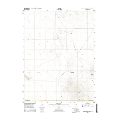
2014 Map of Buena Vista Hills North
USGS Topo · Published 2014About this map
Old Emigrant Rd traces a path through this high desert landscape, following historical movement patterns across the northern Buena Vista Hills. This 2014 survey by the U.S. Geological Survey shows a stark terrain where the modern Coal Canyon-Stillwater Rd intersects with older routes near the border of Pershing and Churchill counties. Notable topographic landmarks such as Chocolate Butte and the drainage of Packard Wash define the local geography, providing clear points of reference in an area marked by wide stretches of public land. The map illustrates the sparse infrastructure and the grid of township and range boundaries, including t26n r34e, that still govern the remote Nevada interior.
Find a feature on this map
10 named features on this map. Tap any name to fly to it.
Don’t see what you’re looking for? This feature index may not catch every label — zoom into the map to look around manually.
Map Details
Editions of this 2014 Buena Vista Hills North Map
This is the sole edition of this map. No revisions or reprints were ever made.
Other maps of this area

1908 · Carson Sink
USGS Topo · 1:250,000

1910 · Carson Sink
USGS Topo · 1:250,000

1931 · Lovelock
USGS Topo · 1:250,000

1935 · Lovelock
USGS Topo · 1:250,000

1954 · Buffalo Mtn
USGS Topo · 1:62,500

1955 · Lovelock
USGS Topo · 1:250,000

1956 · Lovelock
USGS Topo · 1:62,500

1957 · Reno
USGS Topo · 1:250,000

1959 · Lovelock
USGS Topo · 1:250,000

1959 · Reno
USGS Topo · 1:250,000