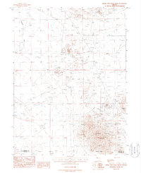
1987 Map of Buena Vista Hills North
USGS Topo · Published 1988About this map
Buena Vista Hills dominate this high-desert landscape in northern Nevada, where industrial mineral extraction is the defining characteristic of the terrain. The 1983 field data reveals a landscape heavily modified by mining activity, particularly concentrated around the southeastern elevations near Chocolate Butte. Numerous Open Pit Mines, Mine Shafts, and associated Tailings are documented throughout the hills, indicating a period of significant activity in the late 20th century. Drainage patterns are led by Packard Wash to the northwest, while a large Dry Lake in the southwest suggests the arid nature of this basin-and-range environment. The map also records the boundary between Pershing and Churchill Counties, crossing through a topography marked by varied prospects and adits that speak to the region's enduring search for resources.
Find a feature on this map
16 named features on this map. Tap any name to fly to it.
Don’t see what you’re looking for? This feature index may not catch every label — zoom into the map to look around manually.
Map Details
Editions of this 1987 Buena Vista Hills North Map
This is the sole edition of this map. No revisions or reprints were ever made.
Other maps of this area

1908 · Carson Sink
USGS Topo · 1:250,000

1910 · Carson Sink
USGS Topo · 1:250,000

1931 · Lovelock
USGS Topo · 1:250,000

1935 · Lovelock
USGS Topo · 1:250,000

1954 · Buffalo Mtn
USGS Topo · 1:62,500

1955 · Lovelock
USGS Topo · 1:250,000

1956 · Lovelock
USGS Topo · 1:62,500

1957 · Reno
USGS Topo · 1:250,000

1959 · Lovelock
USGS Topo · 1:250,000

1959 · Reno
USGS Topo · 1:250,000