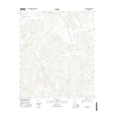
2017 Map of Buena Vista NE
USGS Topo · Published 2017About this map
The creek-carved terrain of northeast Marion County is defined by its winding waterways, including the Kinchafoonee Cr and the branching Pine Knot Cr. This 2017 study illustrates the rural character of the region, where a dense network of county roads like Co RD 56 and Co RD 64 connects dispersed family residences and agricultural tracts. Notable residential development appears at Lambert Lake Ests, situated near the headwaters of Parkers Mill Cr.
Find a feature on this map
64 named features on this map. Tap any name to fly to it.
Don’t see what you’re looking for? This feature index may not catch every label — zoom into the map to look around manually.
Map Details
Editions of this 2017 Buena Vista NE Map
This is the sole edition of this map. No revisions or reprints were ever made.
Other maps of this area

1907 · Talbotton
USGS Topo · 1:125,000

1949 · Glen Alta
USGS Topo · 1:24,000

1949 · Upatoi
USGS Topo · 1:24,000

1949 · Buena Vista NW
USGS Topo · 1:24,000

1950 · Geneva
USGS Topo · 1:24,000

1950 · Buena Vista NE
USGS Topo · 1:24,000

1950 · Buena Vista
USGS Topo · 1:24,000

1950 · Buena Vista
USGS Topo · 1:62,500

1950 · Talbotton
USGS Topo · 1:62,500
1955 · Buena Vista NW
USGS Topo · 1:24,000