
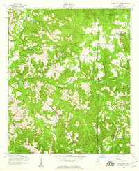
1950 Map of Buena Vista NE
USGS Topo · Published 1953About this map
Parkers Mill and a network of rural churches define the mid-century landscape of Marion County in this survey. The terrain is deeply carved by watercourses, most notably Little Juniper Creek and Pine Knot Creek, which dictate the placement of roads and small agrarian clusters. The prevalence of community landmarks like Bethlehem Ch, Mt Olive Ch, and New Home Ch suggests a period of active congregational life in this corner of Georgia, while the proximity of Sales Chapel Sch and Oakland Sch to these churches highlights the central role of these institutions in local education and social structure.
Find a feature on this map
20 named features on this map. Tap any name to fly to it.
Don’t see what you’re looking for? This feature index may not catch every label — zoom into the map to look around manually.
Map Details
Editions of this 1950 Buena Vista NE Map
This is the sole edition of this map. No revisions or reprints were ever made.
Other maps of this area

1907 · Talbotton
USGS Topo · 1:125,000

1949 · Glen Alta
USGS Topo · 1:24,000

1949 · Upatoi
USGS Topo · 1:24,000

1949 · Buena Vista NW
USGS Topo · 1:24,000

1950 · Geneva
USGS Topo · 1:24,000

1950 · Buena Vista
USGS Topo · 1:24,000

1950 · Buena Vista
USGS Topo · 1:62,500

1950 · Talbotton
USGS Topo · 1:62,500
1955 · Buena Vista NW
USGS Topo · 1:24,000

1955 · Buena Vista
USGS Topo · 1:24,000