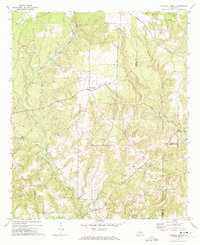
1971 Map of Tazewell North
USGS Topo · Published 1986About this map
Tazewell and the New Liberty Community anchor the southern reaches of this 1971 Georgia survey, where the rolling landscape is defined by the headwaters of Shoal Creek and Cedar Creek. The settlement pattern reflects a rural society centered around small congregation points such as Acorn Grove Ch, Mt Pisgah Ch, and Trinity Ch. In the northeast corner, the Seaboard Coast Line railroad cuts across the Marion and Taylor County line, marking the primary industrial infrastructure of the era.
Find a feature on this map
17 named features on this map. Tap any name to fly to it.
Don’t see what you’re looking for? This feature index may not catch every label — zoom into the map to look around manually.
Map Details
Editions of this 1971 Tazewell North Map
2 editions found
Other maps of this area

1907 · Talbotton
USGS Topo · 1:125,000

1950 · Geneva
USGS Topo · 1:24,000

1950 · Buena Vista NE
USGS Topo · 1:24,000

1950 · Buena Vista
USGS Topo · 1:24,000

1950 · Buena Vista
USGS Topo · 1:62,500

1950 · Talbotton
USGS Topo · 1:62,500

1955 · Buena Vista
USGS Topo · 1:24,000

1955 · Buena Vista NE
USGS Topo · 1:24,000
1955 · Geneva
USGS Topo · 1:24,000
1955 · Talbotton
USGS Topo · 1:62,500