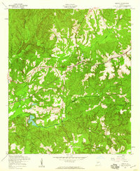
1955 Map of Geneva
USGS Topo · Published 1959About this map
The Central of Georgia railroad defines the central corridor of this mid-century landscape, threading through the settlement of Geneva and the neighboring Juniper Sta. This area on the Talbot and Marion County line is characterized by a dense network of watercourses, including the Upatoi Creek and its southern fork, which feed into Juniper Lake.
Find a feature on this map
20 named features on this map. Tap any name to fly to it.
Don’t see what you’re looking for? This feature index may not catch every label — zoom into the map to look around manually.
Map Details
Editions of this 1955 Geneva Map
2 editions found
Other maps of this area

1907 · Talbotton
USGS Topo · 1:125,000

1949 · Upatoi
USGS Topo · 1:24,000

1949 · Buena Vista NW
USGS Topo · 1:24,000

1950 · Talbotton
USGS Topo · 1:24,000

1950 · Geneva
USGS Topo · 1:24,000

1950 · Waverly Hall
USGS Topo · 1:24,000

1950 · Buena Vista NE
USGS Topo · 1:24,000

1950 · Buena Vista
USGS Topo · 1:62,500

1950 · Talbotton
USGS Topo · 1:62,500

1955 · Talbotton
USGS Topo · 1:24,000