
1950 Map of Talbotton
USGS Topo · Published 1953About this map
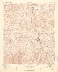
The town of Talbotton serves as the focal point of this mid-century Georgia survey, sitting at the junction of the Atlantic Coast Line railroad and the Macon and Atlantic Road. The landscape is defined by a dense network of watercourses, including Lazar Creek and Marshall Creek, which carve through the undulating terrain. Small rural landmarks like Upatoie Ch and Powell Sch are scattered across the quadrangle, reflecting the importance of local community centers in this era. The presence of the Beall settlement and several unnamed cemeteries highlights the genealogical value of the map, while industrial features such as a Lookout tower and a Pumping Sta near the railroad indicate the technological infrastructure of the early 1950s. The intricate drainage patterns, including Upatoie Creek and Olive Branch Creek, show how the natural geography dictated the placement of roads and homesteads.
Find a feature on this map
23 named features on this map. Tap any name to fly to it.
Don’t see what you’re looking for? This feature index may not catch every label — zoom into the map to look around manually.
Map Details
Editions of this 1950 Talbotton Map
2 editions found
Other maps of this area

1907 · Talbotton
USGS Topo · 1:125,000

1934 · Warm Springs
USGS Topo · 1:62,500

1935 · Thomaston
USGS Topo · 1:48,000

1936 · Warm Springs
USGS Topo · 1:62,500

1939 · Thomaston
USGS Topo · 1:62,500

1949 · Upatoi
USGS Topo · 1:24,000

1950 · Geneva
USGS Topo · 1:24,000

1950 · Waverly Hall
USGS Topo · 1:24,000

1950 · Talbotton
USGS Topo · 1:62,500

1955 · Talbotton
USGS Topo · 1:24,000