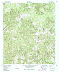
1955 Map of Buena Vista NE
USGS Topo · Published 1986About this map
Parkers and Hardage anchor this rural landscape in Marion County, where the terrain is defined by the winding paths of Little Juniper Creek and Pine Mill Creek. The distribution of community life is evident through a network of small churches, including Mt Olive Ch in the north and Hillyard Ch to the south. These landmarks, along with New Home Ch and Spring Hill Ch, suggest a sparsely populated but deeply rooted agricultural society. Topographic details recorded by the Army Map Service reveal a series of ridges and valleys that likely dictated local travel and land use before mid-century. Researchers will find interest in the several unidentified Cem locations and the specific water features like Heards Lakes, which reflect the area's natural drainage patterns.
Find a feature on this map
17 named features on this map. Tap any name to fly to it.
Don’t see what you’re looking for? This feature index may not catch every label — zoom into the map to look around manually.
Map Details
Editions of this 1955 Buena Vista NE Map
2 editions found

Other maps of this area

1907 · Talbotton
USGS Topo · 1:125,000

1949 · Glen Alta
USGS Topo · 1:24,000

1949 · Upatoi
USGS Topo · 1:24,000

1949 · Buena Vista NW
USGS Topo · 1:24,000

1950 · Geneva
USGS Topo · 1:24,000

1950 · Buena Vista NE
USGS Topo · 1:24,000

1950 · Buena Vista
USGS Topo · 1:24,000

1950 · Buena Vista
USGS Topo · 1:62,500

1950 · Talbotton
USGS Topo · 1:62,500
1955 · Buena Vista NW
USGS Topo · 1:24,000