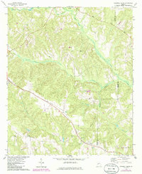
1971 Map of Tazewell South
USGS Topo · Published 1986About this map
The Central of Georgia railroad corridor anchors the southern landscape of this Marion County territory, tracing a path through the settlements of Doyle and Putnam. The area's social fabric is revealed through numerous country churches and cemeteries, including Mahala Chapel and the Corinth Sem Ch, which served these rural communities in the early 1970s. The topography is defined by the winding course of Oochee Creek and Buck Creek, which drain into the larger network near the border with Schley County.
Find a feature on this map
27 named features on this map. Tap any name to fly to it.
Don’t see what you’re looking for? This feature index may not catch every label — zoom into the map to look around manually.
Map Details
Editions of this 1971 Tazewell South Map
2 editions found

Other maps of this area

1950 · Buena Vista NE
USGS Topo · 1:24,000

1950 · Buena Vista
USGS Topo · 1:24,000

1950 · Buena Vista
USGS Topo · 1:62,500

1955 · Buena Vista
USGS Topo · 1:24,000

1955 · Buena Vista NE
USGS Topo · 1:24,000
1955 · Buena Vista
USGS Topo · 1:62,500

1955 · Phenix City
USGS Topo · 1:250,000

1957 · Phenix City
USGS Topo · 1:250,000

1958 · Phenix City
USGS Topo · 1:250,000

1971 · Rupert
USGS Topo · 1:24,000