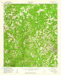
1955 Map of Buena Vista
USGS Topo · Published 1961About this map
Buena Vista serves as the regional hub for Marion County in the mid-1950s, anchoring an agricultural and timbered landscape defined by its deep network of country churches and small rural settlements. The western edge of the area is dominated by the Fort Benning Military Reservation, which marks a sharp transition from civilian farmsteads to restricted military lands. Moving east, the map reveals a constellation of community centers such as Glen Alta, Union, and Berginville, often built around local landmarks like Liberty Hill Ch or St Matthew Sch.
Find a feature on this map
66 named features on this map. Tap any name to fly to it.
Don’t see what you’re looking for? This feature index may not catch every label — zoom into the map to look around manually.
Map Details
Editions of this 1955 Buena Vista Map
This is the sole edition of this map. No revisions or reprints were ever made.
Other maps of this area

1907 · Talbotton
USGS Topo · 1:125,000

1908 · Columbus
USGS Topo · 1:62,500

1929 · Columbus
USGS Topo · 1:48,000

1947 · Columbus
USGS Topo · 1:62,500

1949 · Midland
USGS Topo · 1:24,000

1949 · Glen Alta
USGS Topo · 1:24,000

1949 · Upatoi
USGS Topo · 1:24,000

1949 · Ochillee
USGS Topo · 1:24,000

1949 · Buena Vista NW
USGS Topo · 1:24,000

1949 · Cusseta
USGS Topo · 1:24,000