
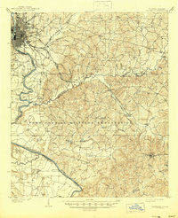
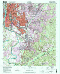
1929 Map of Columbus
USGS Topo · Published 1929About this map
Fort Benning occupies a vast portion of this landscape east of the Chattahoochee River, shown during a period of significant military development between the world wars. The map details the complex terrain of the military reservation, identifying dozens of family-named landmarks such as Davis Hill, Reynolds Hill, and Holliday Hill that define the ridges between Upatoi Creek and Ochillee Creek. These names likely reflect the previous agrarian owners of the land acquired for the post's expansion.
Find a feature on this map
96 named features on this map. Tap any name to fly to it.
Don’t see what you’re looking for? This feature index may not catch every label — zoom into the map to look around manually.
Map Details
Editions of this 1929 Columbus Map
This is the sole edition of this map. No revisions or reprints were ever made.
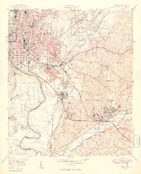
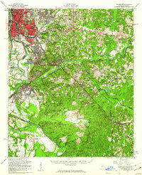
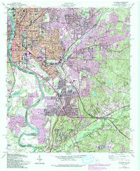
Historical Maps of Columbus Through Time
12 maps found
1908 Columbus
Muscogee County, GA
1929 Columbus
Muscogee County, GA

1947 Columbus
Muscogee County, GA
1949 Columbus
Muscogee County, GA
1955 Columbus
Muscogee County, GA
1955 Columbus
Muscogee County, GA
1999 Columbus
Muscogee County, GA
2011 Columbus
Muscogee County, GA
2014 Columbus
Muscogee County, GA
2017 Columbus
Muscogee County, GA
2020 Columbus
Muscogee County, GA
2024 Columbus
Muscogee County, GA