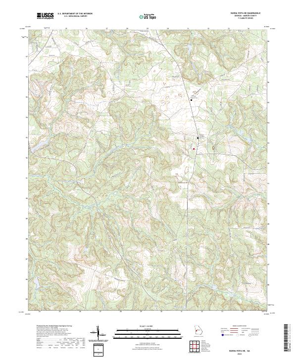
2024 Map of Buena Vista NE
USGS Topo · Published 2024About this map
The community of Bethany anchors the upper reaches of Marion County in this contemporary landscape, where timber and agricultural roads navigate a complex network of tributaries. The terrain is defined by its watercourses, including the westward-flowing Parkers Mill Creek and Little Juniper Creek, which feed into larger systems like Fort Perry Creek and Kinchafoonee Creek. These waterways historically influenced the placement of local infrastructure, as seen with Hardage Ford Creek and the high ground along Backbone Ridge Rd. For those researching local history, the area near Oakland Rd remains a significant focal point, containing both the Oakland Baptist Cem and the Oakland Church of God Cem, serving as enduring landmarks for the surrounding rural homesteads. The southern portion of the map is marked by Melton Lake and Heards Lakes, highlighting the local reliance on managed water resources for recreation or agriculture.
Find a feature on this map
65 named features on this map. Tap any name to fly to it.
Don’t see what you’re looking for? This feature index may not catch every label — zoom into the map to look around manually.
Map Details
Editions of this 2024 Buena Vista NE Map
This is the sole edition of this map. No revisions or reprints were ever made.
Other maps of this area

1907 · Talbotton
USGS Topo · 1:125,000

1949 · Glen Alta
USGS Topo · 1:24,000

1949 · Upatoi
USGS Topo · 1:24,000

1949 · Buena Vista NW
USGS Topo · 1:24,000

1950 · Geneva
USGS Topo · 1:24,000

1950 · Buena Vista NE
USGS Topo · 1:24,000

1950 · Buena Vista
USGS Topo · 1:24,000

1950 · Buena Vista
USGS Topo · 1:62,500

1950 · Talbotton
USGS Topo · 1:62,500
1955 · Buena Vista NW
USGS Topo · 1:24,000