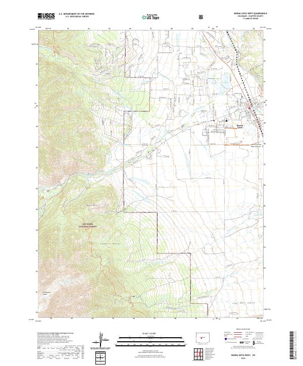
2022 Map of Buena Vista West
USGS Topo · Published 2022About this map
Sawatch Range peaks dominate the western horizon of this Chaffee County landscape, where the high-altitude wilderness of the San Isabel National Forest meets the developed valley floor. The town of Buena Vista serves as the focal point, situated at the confluence of several vital water management systems including the Cottonwood Maxwell Ditch, Wolf and Neerland Ditch, and Mary Bray Ditch. These irrigation features, along with others like the McKenna Ditch and Riverside Ditch, illustrate the sophisticated hydraulic engineering required to support high-desert agriculture and settlement in the shadow of the Collegiate Peaks. Local history is anchored by Mount Olivet Cem and the Central Colorado Regional Airport, while the eastern boundary is defined by the Arkansas River. The terrain transitions from the steep slopes of Bald Mtn down through Charcoal Gulch and Coal Kiln Gulch, reflecting the area's geological and extractive history.
Find a feature on this map
138 named features on this map. Tap any name to fly to it.
Don’t see what you’re looking for? This feature index may not catch every label — zoom into the map to look around manually.
Map Details
Editions of this 2022 Buena Vista West Map
This is the sole edition of this map. No revisions or reprints were ever made.
Other maps of this area

1940 · Garfield
USGS Topo · 1:62,500

1945 · Garfield
USGS Topo · 1:62,500

1955 · Buena Vista
USGS Topo · 1:62,500

1955 · Mount Harvard
USGS Topo · 1:62,500

1956 · Poncha Springs
USGS Topo · 1:62,500

1956 · Montrose
USGS Topo · 1:250,000

1959 · Montrose
USGS Topo · 1:250,000

1960 · Montrose
USGS Topo · 1:250,000

1968 · Montrose
USGS Topo · 1:250,000

1982 · Buena Vista West
USGS Topo · 1:24,000