
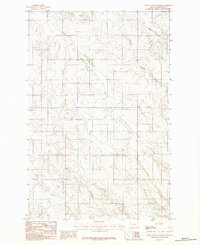
1983 Map of Buffalo Creek
USGS Topo · Published 1983About this map
The Redwater River winds through this section of eastern Montana, marking a landscape defined by an intricate network of drainage systems. At the time of this 1983 provisional survey, the hydrology of the region was centered on Buffalo Creek and its major tributaries, the North Fork Buffalo Creek and South Fork Buffalo Creek. These seasonal watercourses, along with Duck Creek and Corral Creek, shaped the ranching and agricultural potential of the terrain.
Find a feature on this map
10 named features on this map. Tap any name to fly to it.
Don’t see what you’re looking for? This feature index may not catch every label — zoom into the map to look around manually.
Map Details
Editions of this 1983 Buffalo Creek Map
This is the sole edition of this map. No revisions or reprints were ever made.
Other maps of this area

1954 · Glendive
USGS Topo · 1:250,000

1957 · Glendive
USGS Topo · 1:250,000

1958 · Glendive
USGS Topo · 1:250,000

1982 · Circle
USGS Topo · 1:100,000

1983 · Hudiburgh Reservoir
USGS Topo · 1:24,000

1983 · Woodworth Hill
USGS Topo · 1:24,000

1983 · Buffalo Creek NE
USGS Topo · 1:24,000

1983 · Circle
USGS Topo · 1:24,000

1983 · Beery Reservoir
USGS Topo · 1:24,000
1983 · Olson Coulee North
USGS Topo · 1:24,000