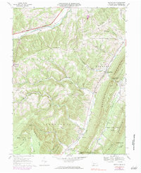
1967 Map of Buffalo Mills
USGS Topo · Published 1984About this map
The Raystown Branch Juniata River flows through the northern reaches of this Bedford County landscape, where the Pennsylvania Turnpike cuts across the ridge-and-valley terrain. Significant local heritage is preserved in the small settlements and religious landmarks scattered throughout the townships of Juniata, Harrison, and Londonderry. In the central valley, the Penn Central railroad parallels Wills Creek, connecting the hamlets of Buffalo Mills, Bard, and Madley.
Find a feature on this map
53 named features on this map. Tap any name to fly to it.
Don’t see what you’re looking for? This feature index may not catch every label — zoom into the map to look around manually.
Map Details
Editions of this 1967 Buffalo Mills Map
Other maps of this area

1908 · Bedford
USGS Topo · 1:62,500

1910 · Bedford
USGS Topo · 1:62,500

1914 · Windber
USGS Topo · 1:62,500

1916 · Windber
USGS Topo · 1:62,500

1923 · Berlin
USGS Topo · 1:48,000

1927 · Hyndman
USGS Topo · 1:62,500

1929 · Berlin
USGS Topo · 1:62,500

1931 · Hyndman
USGS Topo · 1:62,500

1944 · Hyndman
USGS Topo · 1:62,500

1944 · Windber
USGS Topo · 1:62,500
Featured Places
- Cumberland Valley Township, PA
- Harrison Township, PA
- Madley, Londonderry Township
- Buffalo Mills, Harrison Township
- Kegg, Juniata Township