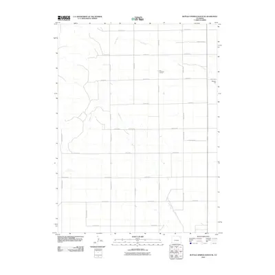
2010 Map of Buffalo Springs Ranch NE
USGS Topo · Published 2010About this map
Kelly Community Cemetery stands as a quiet cultural anchor in this corner of Logan County, positioned among a grid of section-line roads that define the region's agricultural layout. The landscape is shaped by the subtle drainage patterns of Coyote Creek and Rock Creek, which meander across the plains towards the eastern edge of the survey. Rising above the surrounding terrain, Glacken Hill provides a distinct topographical landmark in an area otherwise characterized by steady, open expanses. This 2010 depiction documents the persistent network of rural infrastructure, including County Road MM and County Road 58, which have long facilitated transport for local ranching and farming operations.
Find a feature on this map
25 named features on this map. Tap any name to fly to it.
Don’t see what you’re looking for? This feature index may not catch every label — zoom into the map to look around manually.
Map Details
Editions of this 2010 Buffalo Springs Ranch NE Map
This is the sole edition of this map. No revisions or reprints were ever made.
Other maps of this area

1951 · Reiradon Hill
USGS Topo · 1:24,000

1951 · Sterling South
USGS Topo · 1:24,000

1954 · Sterling
USGS Topo · 1:250,000

1958 · Sterling
USGS Topo · 1:250,000

1972 · Glacken Hill
USGS Topo · 1:24,000

1972 · Leroy
USGS Topo · 1:24,000

1972 · Burdett
USGS Topo · 1:24,000

1973 · Buffalo Springs Ranch NW
USGS Topo · 1:24,000

1973 · Buffalo Springs Ranch NE
USGS Topo · 1:24,000

1973 · Buffalo Springs Ranch SE
USGS Topo · 1:24,000