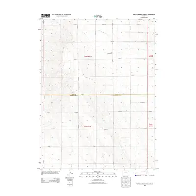
2013 Map of Buffalo Springs Ranch NE
USGS Topo · Published 2013About this map
Kelly Community Cem serves as a quiet local landmark in this corner of the Colorado high plains, situated near the headwaters of Coyote Creek. This landscape is defined by the transition between Logan and Washington Counties, where a rigid grid of section-line roads like CO Road 61 and CO Road 2 imposes order on the arid terrain. The map captures the subtle drainage patterns of Rock Creek as it winds southward, illustrating the geographic importance of seasonal watercourses in an agricultural region dominated by large ranch tracts. The surveyor’s meticulous documentation of township and range lines, such as t006n r051w, underscores the enduring legacy of the Public Land Survey System in organizing this sparsely populated ranching territory.
Find a feature on this map
30 named features on this map. Tap any name to fly to it.
Don’t see what you’re looking for? This feature index may not catch every label — zoom into the map to look around manually.
Map Details
Editions of this 2013 Buffalo Springs Ranch NE Map
This is the sole edition of this map. No revisions or reprints were ever made.
Other maps of this area

1951 · Reiradon Hill
USGS Topo · 1:24,000

1951 · Sterling South
USGS Topo · 1:24,000

1954 · Sterling
USGS Topo · 1:250,000

1958 · Sterling
USGS Topo · 1:250,000

1972 · Glacken Hill
USGS Topo · 1:24,000

1972 · Leroy
USGS Topo · 1:24,000

1972 · Burdett
USGS Topo · 1:24,000

1973 · Buffalo Springs Ranch NW
USGS Topo · 1:24,000

1973 · Buffalo Springs Ranch NE
USGS Topo · 1:24,000

1973 · Buffalo Springs Ranch SE
USGS Topo · 1:24,000