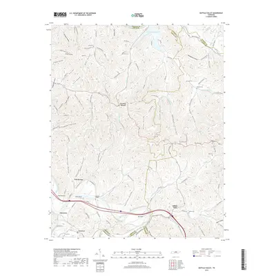
2019 Map of Buffalo Valley
USGS Topo · Published 2019About this map
Chestnut Mound sits at the high point of a ridge-riven landscape where Smith, Putnam, and DeKalb counties converge. This 2019 survey documents a terrain defined by deep hollows and the meandering course of the Caney Fork, which cuts through the southern reaches near Lancaster and Sebowisha. The river’s path creates prominent features such as Bettys Bend and Congo Bottom, illustrating the historical reliance on these fertile lowlands before modern infrastructure bypassed the riverbanks. To the north, the Cordell Hull Reservoir reaches into the hills via Enigma Br, while the Laycock Bridge spans the waters near the confluence of Smith Fork Creek. The map details a dense network of family-named hollows, including Allgier Hollow and Blair Hollow, which speak to the generations of settlement in this part of Middle Tennessee. The town of Buffalo Valley serves as a focal point in the southeast, connected to the surrounding ridges by a web of local roads like Pettys Ridge Rd and Ensor Hollow Rd.
Find a feature on this map
115 named features on this map. Tap any name to fly to it.
Don’t see what you’re looking for? This feature index may not catch every label — zoom into the map to look around manually.
Map Details
Editions of this 2019 Buffalo Valley Map
This is the sole edition of this map. No revisions or reprints were ever made.
Other maps of this area

1925 · Gainesboro
USGS Topo · 1:62,500

1928 · Gordonsville
USGS Topo · 1:62,500

1929 · Gainesboro
USGS Topo · 1:62,500

1932 · Carthage
USGS Topo · 1:62,500

1942 · Statesville
USGS Topo · 1:100,000

1943 · Cookeville
USGS Topo · 1:100,000

1944 · Cookeville
USGS Topo · 1:100,000

1955 · Baxter
USGS Topo · 1:24,000

1956 · Silver Point
USGS Topo · 1:24,000

1956 · Corbin
USGS Topo · 1:250,000