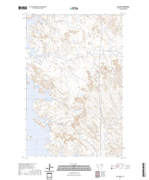
2024 Map of Bug Creek
USGS Topo · Published 2024About this map
Charles M Russell National Wildlife Refuge dominates this stretch of McCone County, where the high prairie meets the complex drainage networks of the Missouri River breaks. The landscape is defined by its dramatic relief, featuring prominent family-named landmarks such as Lonnies Bench and Daniels Point. A sophisticated network of coulees and creeks, including Robinson Coulee, Black Spring Coulee, and Bug Creek, carve through the terrain toward the larger Big Dry Creek drainage.
Find a feature on this map
25 named features on this map. Tap any name to fly to it.
Don’t see what you’re looking for? This feature index may not catch every label — zoom into the map to look around manually.
Map Details
Editions of this 2024 Bug Creek Map
This is the sole edition of this map. No revisions or reprints were ever made.
Other maps of this area

1954 · Jordan
USGS Topo · 1:250,000

1956 · Jordan
USGS Topo · 1:250,000

1958 · Jordan
USGS Topo · 1:250,000

1964 · Jordan
USGS Topo · 1:250,000

1972 · Short Creek
USGS Topo · 1:24,000
1972 · Spring Creek Bay
USGS Topo · 1:24,000

1972 · Ash Creek East
USGS Topo · 1:24,000

1973 · Crow Springs
USGS Topo · 1:24,000
1973 · Willis Buttes
USGS Topo · 1:24,000
1973 · Sand Arroyo
USGS Topo · 1:24,000