
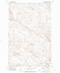
1972 Map of Short Creek
USGS Topo · Published 1975About this map
The Charles M. Russell National Wildlife Range dominates the eastern half of this landscape, where the broken coulees of Garfield County meet the waters of the Fort Dry Peck Lake Arm. The map reveals a remote ranching territory defined by intricate drainage systems like Lone Tree Creek, Bridge Coulee, and Snap Creek. Human presence is sparse, centered around the Flint Ranch and isolated infrastructure such as a Drill Hole and Well. Significant topographic landmarks along the shoreline include Stubby Point and North Twitchell Pt, overlooking the expansive reservoir. The southern edge is defined by the winding course of Big Dry Creek as it moves toward Egan Flat, illustrating the transition from upland grazing territory to the complex riparian network of the Missouri River breaks.
Find a feature on this map
18 named features on this map. Tap any name to fly to it.
Don’t see what you’re looking for? This feature index may not catch every label — zoom into the map to look around manually.
Map Details
Editions of this 1972 Short Creek Map
This is the sole edition of this map. No revisions or reprints were ever made.
Other maps of this area

1954 · Jordan
USGS Topo · 1:250,000

1956 · Jordan
USGS Topo · 1:250,000

1958 · Jordan
USGS Topo · 1:250,000

1964 · Jordan
USGS Topo · 1:250,000

1967 · Hagen Gap
USGS Topo · 1:24,000

1967 · Frank Coulee
USGS Topo · 1:24,000

1972 · Flat Creek School
USGS Topo · 1:24,000

1972 · Ash Creek East
USGS Topo · 1:24,000
1972 · Ash Creek West
USGS Topo · 1:24,000

1973 · Nelson Creek Bay
USGS Topo · 1:24,000