
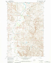
1967 Map of Frank Coulee
USGS Topo · Published 1970About this map
The Charles M. Russell National Wildlife Range spans much of this landscape in eastern Montana, where the rugged Missouri River breaks transition into the prairie uplands. This 1967 field-checked survey captures a remote ranching and conservation territory defined by intricate drainage systems like Frank Coulee and Kerr Coulee. The presence of the Van Norman Sch and specialized local sites like Cedar Bed Ground Reservoir point to the scattered human footprint in Garfield and McCone counties. Water management is central to the area's utility, evidenced by the numerous wells and tanks such as the Flowing Well and Boelk Well, while the northern edge of the map meets the massive Fort Peck Reservoir. Natural landmarks like Indian Rocks and Standing Rock provide distinct navigational points in a terrain dominated by the winding path of Big Dry Creek.
Find a feature on this map
33 named features on this map. Tap any name to fly to it.
Don’t see what you’re looking for? This feature index may not catch every label — zoom into the map to look around manually.
Map Details
Editions of this 1967 Frank Coulee Map
2 editions found
Other maps of this area

1954 · Jordan
USGS Topo · 1:250,000

1956 · Jordan
USGS Topo · 1:250,000

1958 · Jordan
USGS Topo · 1:250,000

1964 · Jordan
USGS Topo · 1:250,000

1967 · Hagen Gap
USGS Topo · 1:24,000
1967 · Maxwell Coulee
USGS Topo · 1:24,000

1967 · Coal Creek
USGS Topo · 1:24,000

1972 · Short Creek
USGS Topo · 1:24,000

1972 · Flat Creek School
USGS Topo · 1:24,000

1973 · Nelson Creek Bay
USGS Topo · 1:24,000