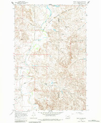
1967 Map of Frank Coulee
USGS Topo · Published 1984About this map
The Charles M Russell National Wildlife Range dominates the northern landscape of this 1967 survey, where the convoluted terrain of Garfield and McCone counties meets the southern reaches of Fort Peck Reservoir. This is a country of deep drainages and intermittent water, defined by the winding course of Big Dry Creek and its many tributaries, such as Frank Coulee and Fortyfour Coulee.
Find a feature on this map
32 named features on this map. Tap any name to fly to it.
Don’t see what you’re looking for? This feature index may not catch every label — zoom into the map to look around manually.
Map Details
Editions of this 1967 Frank Coulee Map
2 editions found
Other maps of this area

1954 · Jordan
USGS Topo · 1:250,000

1956 · Jordan
USGS Topo · 1:250,000

1958 · Jordan
USGS Topo · 1:250,000

1964 · Jordan
USGS Topo · 1:250,000

1967 · Hagen Gap
USGS Topo · 1:24,000
1967 · Maxwell Coulee
USGS Topo · 1:24,000

1967 · Coal Creek
USGS Topo · 1:24,000

1967 · Frank Coulee
USGS Topo · 1:24,000

1972 · Short Creek
USGS Topo · 1:24,000

1972 · Flat Creek School
USGS Topo · 1:24,000