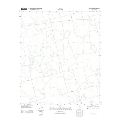
2012 Map of Bull Creek
USGS Topo · Published 2012About this map
Clear Fork and its network of seasonal tributaries define the landscape of this Fisher County region during the early twenty-first century. The terrain is structured by a grid of county roads and ranch paths, punctuated by small reservoirs like Gober Lake and Davenport Lake. These water sources are critical features in a semi-arid environment, serving the surrounding ranchlands and agricultural plots. The drainage patterns of Buffalo Cr, Bull Cr, and Alkali Cr reveal the natural topography of the Texas Rolling Plains, showing how water movement has shaped the local land use. While the map is dominated by open country, the intersection of Fm-611 and various county routes, such as Co RD-312 and Co RD-448, illustrates the rural infrastructure necessary for navigating this expansive territory.
Find a feature on this map
23 named features on this map. Tap any name to fly to it.
Don’t see what you’re looking for? This feature index may not catch every label — zoom into the map to look around manually.
Map Details
Editions of this 2012 Bull Creek Map
This is the sole edition of this map. No revisions or reprints were ever made.
Other maps of this area

1893 · Roby
USGS Topo · 1:125,000

1931 · Rotan
USGS Topo · 1:62,500

1932 · Camp Springs
USGS Topo · 1:62,500

1954 · Big Spring
USGS Topo · 1:250,000

1958 · Big Spring
USGS Topo · 1:250,000

1969 · Camp Springs
USGS Topo · 1:24,000

1969 · Rotan
USGS Topo · 1:24,000

1969 · Busby
USGS Topo · 1:24,000

1969 · Bull Creek
USGS Topo · 1:24,000

1969 · Inadale NW
USGS Topo · 1:24,000