
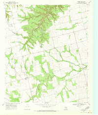
1969 Map of Inadale NW
USGS Topo · Published 1972About this map
The Clear Fork Brazos River winds through this West Texas landscape, marking a topographically varied area at the intersection of Scurry and Fisher counties. In the late 1960s, the region reflected a mix of ranching foundations and modern infrastructure, evidenced by the Snyder Rotan Aqueduct cutting across the northern reaches and the At & Sf railroad line in the southwest. The small settlement of Midway and the Roadside Park along the highway serve as key markers for travelers and local residents alike.
Find a feature on this map
14 named features on this map. Tap any name to fly to it.
Don’t see what you’re looking for? This feature index may not catch every label — zoom into the map to look around manually.
Map Details
Editions of this 1969 Inadale NW Map
This is the sole edition of this map. No revisions or reprints were ever made.
Other maps of this area

1932 · Camp Springs
USGS Topo · 1:62,500

1952 · China Grove
USGS Topo · 1:24,000

1952 · Hermleigh
USGS Topo · 1:24,000

1954 · Lloyd Mountain
USGS Topo · 1:24,000

1954 · Big Spring
USGS Topo · 1:250,000

1958 · Big Spring
USGS Topo · 1:250,000

1969 · Camp Springs
USGS Topo · 1:24,000

1969 · Bull Creek
USGS Topo · 1:24,000

1969 · Bernecker
USGS Topo · 1:24,000
1969 · Hobbs
USGS Topo · 1:24,000