Old Maps of Scurry County, Texas
Explore 125 old maps of Scurry County, spanning from 1932 to today. These high-resolution historic maps reveal how streets, neighborhoods, landmarks, and natural features evolved over time — perfect for genealogy, metal detecting, research, and local history exploration.
What you can do with these maps:
- See how Scurry County changed over time: Compare historical maps to modern-day views to trace roads, homesites, rail lines & more.
- View detailed metadata: Each map includes creators, publishers, year, scale, and archive source.
- Overlay maps with satellite & LiDAR: Visualize the past alongside modern tools to explore terrain & human change.
- Trusted historical sources: Maps sourced from the USGS, Library of Congress, and other archives.
- Access maps your way: View online, download high-res files, or order prints for personal or research use.
Start exploring old maps of Scurry County to uncover forgotten places, hidden landmarks, and the deep history beneath your feet.
Scurry County, TX maps
(125)- 1932 Map of Camp Springs
 1932 Camp Springs1932 Print · USGSIn the 1930s, the borderlands of Kent and Fisher Counties featured a deeply dissected landscape carved by the Double Mountain Fork Brazos River. Local historians can trace the rural landscape of the era through landmarks like the County Line Sch and the expanse of Longhorn Valley.2 unique versions available
 - 1951 Map of Ira SW
 1951 Ira SW1951 Print · USGSTexas ranching and early petroleum development meet in the early 1950s where four counties converge. Trace the landscape of the Conrad Ranch, find the Colorado River, and locate industrial markers like the Oil Well and Oil Tanks.2 unique versions available
 - 1951 Map of Ira
 1951 Ira1951 Print · USGSScurry County's landscape in the early fifties was defined by the winding Colorado River and the expanding energy sector. Genealogists and historians can trace the settlement at Ira, find family markers at Ira Cem, and locate early Oil Wells across the Sharon Bluff Oil Field.2 unique versions available
 - 1951 Map of Dunn
 1951 Dunn1951 Print · USGSThe Scurry County oil fields take center stage in the early fifties, showing the industrial landscape along the Colorado River. Trace the development of Dunn and Ira alongside landmarks like Sharon Ridge and the local Cem.2 unique versions available
 - 1951 Map of Ira NW, 1953 Print
 1951 Ira NW1953 Print · USGSBorden and Scurry counties were at the height of a mid-century energy boom when this survey was completed. Researchers can trace the extensive early infrastructure of the Diamond M Oil Field or locate local landmarks like the Union Sch and the 9R Ranch.2 unique versions available
 - 1952 Map of Snyder, 1953 Print
 1952 Snyder1953 Print · USGSSnyder is shown during its mid-century period of growth, when the petroleum and rail industries shaped this West Texas landscape. Genealogists and researchers can trace the locations of Snyder Cem, Winston Field, and schools like Northwest Sch and Lincoln Sch.3 unique versions available
 - 1952 Map of China Grove, 1953 Print
 1952 China Grove1953 Print · USGSScurry County ranching and rural life are preserved here in the early fifties, just as petroleum infrastructure began to mark the land. Genealogists can locate China Grove, German Sch, and the Roscoe Snyder and Pacific rail line.3 unique versions available
 - 1952 Map of Ira NE, 1953 Print
 1952 Ira NE1953 Print · USGSScurry County's oil-driven landscape is captured here in the early fifties, showing the peak of the post-war energy boom. Researchers can trace the industrial footprint of the Snyder Oil Field alongside rural community hubs like Knapp PO and Canyon Ch.2 unique versions available
 - 1952 Map of Hermleigh, 1953 Print
 1952 Hermleigh1953 Print · USGSHermleigh thrived as a vital rail junction in the early fifties, sitting at the crossroads of two major West Texas lines. Genealogists and researchers can trace the local landscape through the Plainview Sch, the townsite of Hermleigh, and the winding path of Hell Roaring Hollow.2 unique versions available
 - 1954 Map of Lloyd Mountain, 1955 Print
 1954 Lloyd Mountain1955 Print · USGSScurry County land in the mid-fifties is defined here by Lloyd Mountain and a network of seasonal creek beds. Genealogists can locate abandoned local landmarks like the Ennis Creek Sch (Aban'd) and Lloyd Mountain Sch (Aban'd).
 - 1954 Map of Dermott, 1955 Print
 1954 Dermott1955 Print · USGSScurry County at the height of the post-war oil boom shows a landscape transformed by industry and energy. Researchers can trace the extensive Kelly Snyder Oil Field, locate the rail settlement of Dermott, and follow the Old Railroad Grade.2 unique versions available
 - 1954 Map of Brand, 1956 Print
 1954 Brand1956 Print · USGSScurry County's energy landscape is captured mid-century as petroleum infrastructure expands around the Panhandle and Santa Fe rail line. Genealogists and historians can trace the development of Brand and the vast Kelly Snyder Field.2 unique versions available
 - 1954 Map of Big Spring, 1965 Print
 1954 Big Spring1965 Print · USGSWest Texas in the mid-1950s shows a landscape of growing oil towns and vital rail links along the Texas and Pacific RR. Researchers can trace the development of Big Spring, find smaller settlements like Knott and Lomax, or locate landmarks such as Boyds Chapel and Signal Mountain.4 unique versions available
 - 1958 Map of Big Spring
 1958 Big Spring1958 Print · USGSThe West Texas oil boom was in full swing during the late fifties, transforming the landscape around Howard and Mitchell counties. Genealogists and historians can trace the growth of Big Spring and Snyder alongside industrial landmarks like the Kelly-Snyder Oil Field and the Santa Fe rail lines.
 - 1969 Map of Arah, 1971 Print
 1969 Arah1971 Print · USGSThe borderlands of Borden and Scurry Counties are captured here in the late sixties, showing a landscape of ranching and early oil exploration. Genealogists can trace the Fluvanna Cem and York Cem or locate the small settlement of Arah.
 - 1969 Map of Fluvanna, 1971 Print
 1969 Fluvanna1971 Print · USGSFluvanna and the high plains of Scurry and Borden counties are captured here in the late sixties as the local oil industry flourished. Researchers can trace the legacy of the Atchison Topeka and Santa Fe and locate the Fluvanna Cem near the Old Railroad Grade.
 - 1969 Map of Camp Springs, 1972 Print
 1969 Camp Springs1972 Print · USGSThe ranching and oil country of the Scurry and Fisher county line is documented here in the late sixties. Researchers can trace family history at Camp Springs Cem or locate early water sources like Dripping Spring and Spring Creek.
 - 1969 Map of Inadale NW, 1972 Print
 1969 Inadale NW1972 Print · USGSScurry County's rural landscape is captured here in the late sixties as the local economy balanced ranching with utility infrastructure. Genealogists and researchers can locate the Hermleigh Cem or trace the path of the Clear Fork Brazos River and the Snyder Rotan Aqueduct.
 - 1969 Map of Maverick Creek, 1972 Print
 1969 Maverick Creek1972 Print · USGSThe Scurry and Kent County line area comes into focus during the late sixties, highlighting the industrial expansion of the Cogdell Oil Field. Local researchers can trace old energy infrastructure and landmarks like Church Peak, Criswell, and the Pumping Sta.
 - 1969 Map of Hudd, 1972 Print
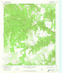 1969 Hudd1972 Print · USGSScurry County ranching and river breaks are documented here in the late sixties, showing the transition from canyonlands to agricultural flats. Researchers can locate the Cottonwood Flat Cem, Criswell Ranch, and landmarks like Sugar Loaf.
 - 1969 Map of Flat Top Mountain, 1972 Print
 1969 Flat Top Mountain1972 Print · USGSScurry County ranching and petroleum fields are shown here in the late sixties, where the railroad meets the rugged hills. You can trace family operations at Williams Ranch or locate rail stops along the Atchison Topeka and Santa Fe near Fullerville.
 - 1969 Map of McKenzie Mountains, 1972 Print
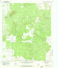 1969 McKenzie Mountains1972 Print · USGSScurry County's petroleum landscape is captured here in the late sixties, where the industrial expansion of the Fuller Oil Field meets the Texas rangeland. Researchers can trace the layout of the Fuller Ranch, the Fuller Landing Strip, and a sprawling network of oil wells and pipelines.
 - 1969 Map of Inadale, 1973 Print
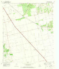 1969 Inadale1973 Print · USGSWest Texas rail junctions and agricultural boundaries are captured here in the late sixties as the region's economy relied on heavy rail transport. Trace the routes of the Roscoe Snyder and Pacific and locate family burial sites at Pyron Cem or Lone Wolf Cem.
 - 1985 Map of Snyder
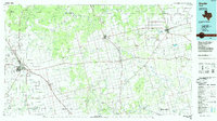 1985 Snyder1985 Print · USGSMid-1980s Scurry and Fisher Counties are captured here as a landscape of rail-driven commerce and river-bottom agriculture. Researchers can trace the pathways of the Missouri Pacific railroad or locate family-named landmarks like Mc Caulley and Hermleigh.2 unique versions available
 - 1986 Map of Lamesa
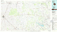 1986 Lamesa1986 Print · USGSWest Texas in the mid-eighties reveals a landscape of massive oil fields and cattle country where the High Plains drop off toward the Colorado River. Genealogists and historians can trace rail-side towns like O'Donnell and Fluvanna, or locate petroleum landmarks such as the Diamond M Oil Field and Jo Mill Oil Field.2 unique versions available
Showing maps 1-25 of 125
Top cities of Scurry County
Frequently asked questions
- What are the different types of historical maps available for Scurry County?
- What is the oldest map of Scurry County?
- Where can I purchase historical maps of Scurry County for my home or office?
- Where can I download high-res historical maps of Scurry County?
- Are there historical topographic maps available for Scurry County?
- Is there historical aerial imagery available for Scurry County?
- Where are historical maps of Scurry County sourced from?