
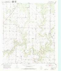
1951 Map of Dunn
USGS Topo · Published 1951About this map
The Colorado River carves a winding path through the southern half of this mid-century survey, establishing the natural boundary between Scurry and Mitchell Counties. The landscape is defined by the energy infrastructure of the era, most notably the expansive Oil Field and the Strain Pool that dominate the southern reaches near Sharon Ridge. These features, alongside numerous industrial Pipe Line labels and windmills, suggest a region shaped by the post-war petroleum boom and rural ranching.
Find a feature on this map
13 named features on this map. Tap any name to fly to it.
Don’t see what you’re looking for? This feature index may not catch every label — zoom into the map to look around manually.
Map Details
Editions of this 1951 Dunn Map
2 editions found
Other maps of this area

1950 · Cedar Bend
USGS Topo · 1:24,000

1951 · Ira
USGS Topo · 1:24,000

1952 · Cuthbert
USGS Topo · 1:24,000

1952 · Snyder
USGS Topo · 1:24,000

1952 · China Grove
USGS Topo · 1:24,000

1952 · Colorado City
USGS Topo · 1:24,000

1952 · Ira NE
USGS Topo · 1:24,000

1952 · Hermleigh
USGS Topo · 1:24,000

1954 · Big Spring
USGS Topo · 1:250,000

1958 · Big Spring
USGS Topo · 1:250,000