
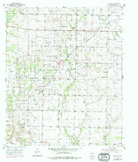
1952 Map of Ira NE
USGS Topo · Published 1953About this map
Snyder Oil Field dominates this 1952 landscape in Scurry County, revealing the mid-century industrial infrastructure of the West Texas oil boom. The map detail highlights an intricate network of energy production, including an Oil Refinery, a Pumping Station, and multiple Oil Tanks clustered near the Panhandle and Santa Fe railroad line. Amidst this heavy industry, rural life persists at small centers like Knapp PO and Franklin Center.
Find a feature on this map
18 named features on this map. Tap any name to fly to it.
Don’t see what you’re looking for? This feature index may not catch every label — zoom into the map to look around manually.
Map Details
Editions of this 1952 Ira NE Map
2 editions found
Other maps of this area

1951 · Ira SW
USGS Topo · 1:24,000

1951 · Ira
USGS Topo · 1:24,000

1951 · Dunn
USGS Topo · 1:24,000

1951 · Ira NW
USGS Topo · 1:24,000

1952 · Snyder
USGS Topo · 1:24,000

1954 · Dermott
USGS Topo · 1:24,000

1954 · Brand
USGS Topo · 1:24,000

1954 · Big Spring
USGS Topo · 1:250,000

1958 · Big Spring
USGS Topo · 1:250,000

1969 · Arah
USGS Topo · 1:24,000