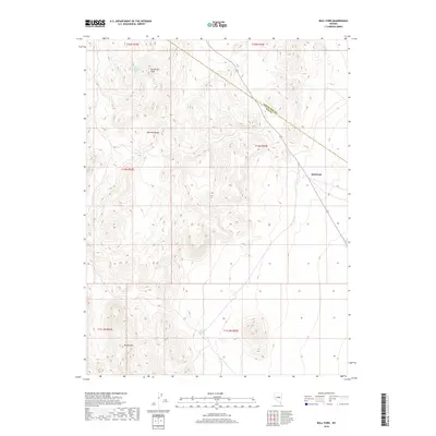
2018 Map of Bull Fork
USGS Topo · Published 2018About this map
Duckwater Peak dominates the northern skyline in this high-elevation corner of Nevada, where the high desert terrain transitions into the steep slopes of the Pancake Range. The landscape is defined by the ephemeral Bull Fork drainage and isolated water sources that have historically supported life in the Great Basin. To the south, Moody Mtn rises above the valley floor, providing a geographical anchor for the surrounding township boundaries. Local history and ranching roots are traced through vital water points like Butte Station Spring and Big Butte Spring, which represent the rare, reliable hydrology necessary for settlement and travel across the arid expanse of Nye Co.
Find a feature on this map
13 named features on this map. Tap any name to fly to it.
Don’t see what you’re looking for? This feature index may not catch every label — zoom into the map to look around manually.
Map Details
Editions of this 2018 Bull Fork Map
This is the sole edition of this map. No revisions or reprints were ever made.
Other maps of this area

1951 · Green Springs
USGS Topo · 1:62,500

1956 · Lund
USGS Topo · 1:250,000

1956 · Ely
USGS Topo · 1:250,000

1959 · Ely
USGS Topo · 1:250,000

1960 · Lund
USGS Topo · 1:250,000

1963 · Ely
USGS Topo · 1:250,000

1964 · Duckwater
USGS Topo · 1:62,500

1964 · Moody Peak
USGS Topo · 1:62,500

1968 · Brown Summit
USGS Topo · 1:24,000
1968 · Brown Summit NW
USGS Topo · 1:24,000