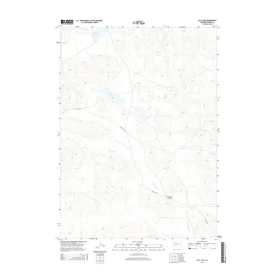
2014 Map of Bull Lake
USGS Topo · Published 2014About this map
Wamaduze Cr meanders through the central and southern reaches of this Sandhills landscape, carving out the prominent Wamaduze Valley as it flows southeast. This 2014 survey documents a remote portion of Cherry County defined by its unique hydrography, where isolated basins like Lone Tree Lake and Bull Lake occupy the interdunal swales typical of this region's geology. Evidence of human transit and ranching infrastructure is centered on Brownlee Rd, which skirts the western edge of Packingham Lake before striking southeast toward the valley. The map provides a precise record of the shoreline and elevation contours of these Nebraska water bodies during the early 21st century.
Find a feature on this map
6 named features on this map. Tap any name to fly to it.
Don’t see what you’re looking for? This feature index may not catch every label — zoom into the map to look around manually.
Map Details
Editions of this 2014 Bull Lake Map
This is the sole edition of this map. No revisions or reprints were ever made.
Other maps of this area

1950 · Simeon
USGS Topo · 1:62,500

1950 · Kennedy
USGS Topo · 1:62,500

1951 · Bull Lake
USGS Topo · 1:62,500

1951 · Brownlee
USGS Topo · 1:62,500

1957 · Valentine
USGS Topo · 1:250,000

1959 · Valentine
USGS Topo · 1:250,000

1985 · Goose Creek
USGS Topo · 1:100,000
1985 · Windmill Lake
USGS Topo · 1:24,000

1985 · Valentine
USGS Topo · 1:100,000
1985 · Kennedy
USGS Topo · 1:24,000