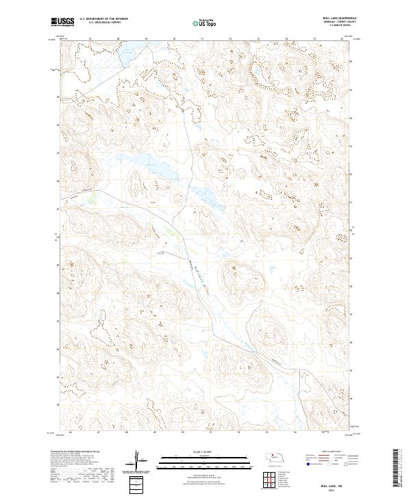
2021 Map of Bull Lake
USGS Topo · Published 2021About this map
Wamaduze Valley carves a distinctive path through the northern reaches of Cherry County, defining the drainage patterns of this sparsely populated portion of the Nebraska Sandhills. The landscape is dominated by isolated water bodies including Bull Lake, Lone Tree Lake, and Stub Lake, which serve as critical landmarks in a region characterized by shifting dunes and internal drainage. The presence of Wamaduze Cr provides a central hydrologic artery, while the local road network is limited primarily to Brownlee Rd, reflecting the low-density ranching environment of the area. This survey by the U.S. Geological Survey illustrates how the natural topography dictates the few corridors of movement, with the terrain's undulating forms and scattered wetlands being the primary features for navigation and land use.
Find a feature on this map
10 named features on this map. Tap any name to fly to it.
Don’t see what you’re looking for? This feature index may not catch every label — zoom into the map to look around manually.
Map Details
Editions of this 2021 Bull Lake Map
This is the sole edition of this map. No revisions or reprints were ever made.
Other maps of this area

1950 · Simeon
USGS Topo · 1:62,500

1950 · Kennedy
USGS Topo · 1:62,500

1951 · Bull Lake
USGS Topo · 1:62,500

1951 · Brownlee
USGS Topo · 1:62,500

1957 · Valentine
USGS Topo · 1:250,000

1959 · Valentine
USGS Topo · 1:250,000

1985 · Goose Creek
USGS Topo · 1:100,000
1985 · Windmill Lake
USGS Topo · 1:24,000

1985 · Valentine
USGS Topo · 1:100,000
1985 · Kennedy
USGS Topo · 1:24,000