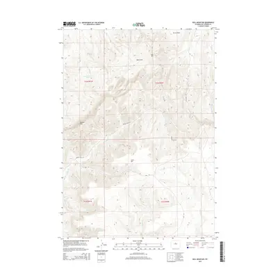
2015 Map of Bull Mountain
USGS Topo · Published 2015About this map
Klondike Peak and Bull Mtn anchor this high-elevation landscape in Hot Springs County, defined by a complex network of seasonal drainages and sharp topographical relief. The arid character of the region is evident in the naming of features like Nowater Cr and Bader Draw, while the Gardner Reservoir Number 3 represents a vital modification for water management in the high desert. The geography is partitioned by the Bridger Creek Rd and Reck Rd, which navigate the contours between Minnick Basin and the southern slopes of Lysite Mtn. The hydrology is dominated by ephemeral systems such as Bridger Cr, Lysite Cr, and Maimes Cr, which carve through the townships and ranges of this central Wyoming region. This map illustrates the intersection of public land management and the natural watershed of the Wind River Basin outskirts.
Find a feature on this map
25 named features on this map. Tap any name to fly to it.
Don’t see what you’re looking for? This feature index may not catch every label — zoom into the map to look around manually.
Map Details
Editions of this 2015 Bull Mountain Map
This is the sole edition of this map. No revisions or reprints were ever made.
Other maps of this area

1952 · Cottonwood Pass
USGS Topo · 1:24,000

1952 · Rathbun Ranch
USGS Topo · 1:24,000

1952 · Arapahoe Butte
USGS Topo · 1:24,000

1952 · De Pass
USGS Topo · 1:24,000

1952 · Battle Mountain
USGS Topo · 1:24,000

1952 · Bull Mountain
USGS Topo · 1:24,000

1955 · Arminto
USGS Topo · 1:250,000

1957 · Rathbun Ranch
USGS Topo · 1:24,000

1958 · Arminto
USGS Topo · 1:250,000

1960 · Packsaddle Creek
USGS Topo · 1:24,000