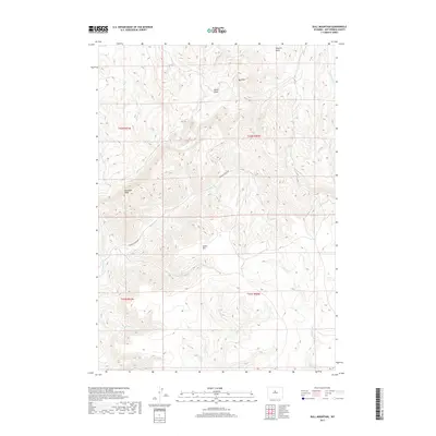
2017 Map of Bull Mountain
USGS Topo · Published 2017About this map
Klondike Peak and Bull Mtn anchor this high-altitude landscape in Hot Springs County, where the terrain is defined by a series of steep drainages and mountain massifs. The area is a complex network of seasonal and perennial waterways, including the headwaters of Bridger Cr, Nowater Cr, and Lysite Cr. Human presence is minimal, primarily limited to Bridger Creek Rd, which winds through the central portion of the quadrangle to connect the various basins. The map illustrates a high-desert environment where natural landmarks like Lysite Mtn and Minnick Basin dominate the geography. Significant elevation changes are visible through the contour lines, tracing the path of Bader Draw and other erosion-formed features that characterize this portion of the Wyoming interior.
Find a feature on this map
20 named features on this map. Tap any name to fly to it.
Don’t see what you’re looking for? This feature index may not catch every label — zoom into the map to look around manually.
Map Details
Editions of this 2017 Bull Mountain Map
This is the sole edition of this map. No revisions or reprints were ever made.
Other maps of this area

1952 · Cottonwood Pass
USGS Topo · 1:24,000

1952 · Rathbun Ranch
USGS Topo · 1:24,000

1952 · Arapahoe Butte
USGS Topo · 1:24,000

1952 · De Pass
USGS Topo · 1:24,000

1952 · Battle Mountain
USGS Topo · 1:24,000

1952 · Bull Mountain
USGS Topo · 1:24,000

1955 · Arminto
USGS Topo · 1:250,000

1957 · Rathbun Ranch
USGS Topo · 1:24,000

1958 · Arminto
USGS Topo · 1:250,000

1960 · Packsaddle Creek
USGS Topo · 1:24,000