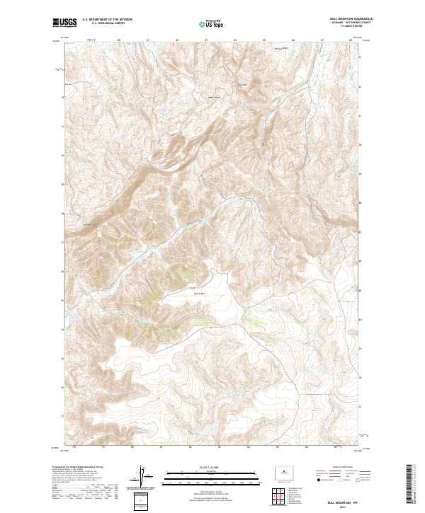
2021 Map of Bull Mountain
USGS Topo · Published 2021About this map
Lysite Mtn and the high ridges of Klondike Peak dominate this landscape in the southeastern corner of Hot Springs County. The map captures a high-elevation terrain defined by complex drainage patterns, where seasonal watercourses like Bridger Cr and Pine Cr carve through the sedimentary layers of the Owl Creek Mountains region. This area, largely defined by public land divisions such as t42n r90w and t41n r91w, reflects the typical ranching and resource-management character of central Wyoming.
Find a feature on this map
19 named features on this map. Tap any name to fly to it.
Don’t see what you’re looking for? This feature index may not catch every label — zoom into the map to look around manually.
Map Details
Editions of this 2021 Bull Mountain Map
This is the sole edition of this map. No revisions or reprints were ever made.
Other maps of this area

1952 · Cottonwood Pass
USGS Topo · 1:24,000

1952 · Rathbun Ranch
USGS Topo · 1:24,000

1952 · Arapahoe Butte
USGS Topo · 1:24,000

1952 · De Pass
USGS Topo · 1:24,000

1952 · Battle Mountain
USGS Topo · 1:24,000

1952 · Bull Mountain
USGS Topo · 1:24,000

1955 · Arminto
USGS Topo · 1:250,000

1957 · Rathbun Ranch
USGS Topo · 1:24,000

1958 · Arminto
USGS Topo · 1:250,000

1960 · Packsaddle Creek
USGS Topo · 1:24,000