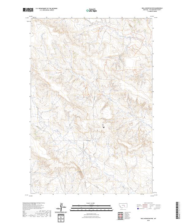
2024 Map of Bull Mountain NW
USGS Topo · Published 2024About this map
Castle Butte Cem serves as a small, grounded focal point for local family history in this corner of Yellowstone County. The surrounding terrain is defined by the high point of Castle Butte and a network of drainages including Mill Creek, Antelope Creek, and Hibbard Creek. These waterways and their associated valleys have long dictated the placement of local thoroughfares like Hibbard Creek Rd and Castle Butte Rd. The map illustrates a rural landscape where the land use is primarily tied to the natural topography and the surveyed section lines of the Public Land Survey System, including t5n r30e and t6n r31e. The path of Ridge Rd follows the high ground, tracing the physical geography of the region as it transitions between different township and range boundaries.
Find a feature on this map
15 named features on this map. Tap any name to fly to it.
Don’t see what you’re looking for? This feature index may not catch every label — zoom into the map to look around manually.
Map Details
Editions of this 2024 Bull Mountain NW Map
This is the sole edition of this map. No revisions or reprints were ever made.
Other maps of this area

1954 · Forsyth
USGS Topo · 1:250,000

1954 · Roundup
USGS Topo · 1:250,000

1957 · Forsyth
USGS Topo · 1:250,000

1958 · Roundup
USGS Topo · 1:250,000

1958 · Forsyth
USGS Topo · 1:250,000
1967 · Big Marys Island
USGS Topo · 1:24,000
1967 · Bull Mountain
USGS Topo · 1:24,000

1979 · Roundup
USGS Topo · 1:100,000

1979 · Hysham
USGS Topo · 1:100,000

1980 · Mud Butte
USGS Topo · 1:24,000