
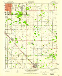
1921 Map of Bullard
USGS Topo · Published 1921About this map
The San Joaquin River forms the northern boundary of this agricultural and urbanizing landscape during the early 1920s, dividing Madera and Fresno counties near Lanes Bridge. The city of Fresno occupies the southern portion of the sheet, revealing a dense grid of streets and the prominent State Normal School campus. This era shows a community defined by its transit networks, where the Southern Pacific and Atchison Topeka and Santa Fe railroads bisect the land, meeting at junctions like Biola Junction.
Find a feature on this map
47 named features on this map. Tap any name to fly to it.
Don’t see what you’re looking for? This feature index may not catch every label — zoom into the map to look around manually.
Map Details
Editions of this 1921 Bullard Map
This is the sole edition of this map. No revisions or reprints were ever made.
Other maps of this area

1922 · Lanes Bridge
USGS Topo · 1:31,680

1922 · Friant
USGS Topo · 1:31,680

1922 · Gregg
USGS Topo · 1:31,680

1923 · Kearney Park
USGS Topo · 1:31,680

1923 · Malaga
USGS Topo · 1:31,680

1923 · Herndon
USGS Topo · 1:31,680

1923 · Fresno
USGS Topo · 1:31,680

1923 · Clovis
USGS Topo · 1:31,680

1923 · Bullard
USGS Topo · 1:31,680
1946 · Malaga
USGS Topo · 1:24,000