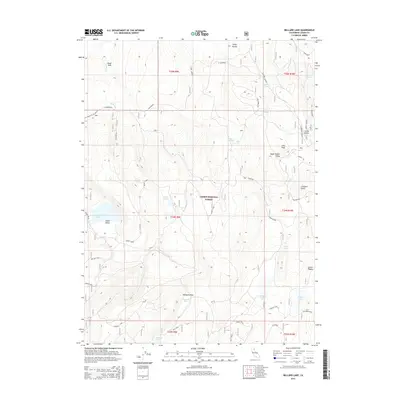
2015 Map of Bullard Lake
USGS Topo · Published 2015About this map
Lassen National Forest terrain dominates this high-altitude landscape in Lassen County, defined by a network of seasonal water sources and named depressions. The hydrology is centered around Big Jack Lake and Bullard Lake, which occupy natural basins alongside Twin Lakes and Gordon Lake. Human presence is marked by historic transit corridors like Board Cabin and Cleghorn Rd, indicating the area's legacy of timber management and seasonal grazing. Dramatic geological features such as Lava Peak and the Stanford Trough provide significant elevation changes, creating distinct ecological zones like Mosquito Flat and Sheep Valley. This survey captures the complex water-management infrastructure necessary for high-desert ranching and forest maintenance, including the W Gordon Well and Pat Morris Spring, which have long served as vital points in this arid environment.
Find a feature on this map
42 named features on this map. Tap any name to fly to it.
Don’t see what you’re looking for? This feature index may not catch every label — zoom into the map to look around manually.
Map Details
Editions of this 2015 Bullard Lake Map
This is the sole edition of this map. No revisions or reprints were ever made.
Other maps of this area

1886 · Honey Lake
USGS Topo · 1:250,000

1886 · Lassen Peak
USGS Topo · 1:250,000

1891 · Honey Lake
USGS Topo · 1:250,000

1892 · Lassen Peak
USGS Topo · 1:250,000

1893 · Honey Lake
USGS Topo · 1:250,000

1894 · Lassen Peak
USGS Topo · 1:250,000

1939 · Halls Flat
USGS Topo · 1:125,000

1955 · Westwood
USGS Topo · 1:250,000

1956 · Hayden Hill
USGS Topo · 1:62,500

1956 · Harvey Mtn
USGS Topo · 1:62,500