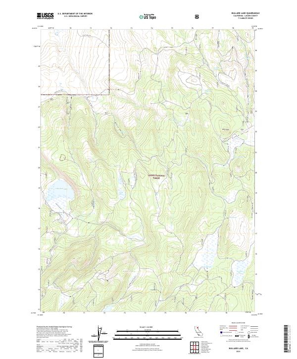
2021 Map of Bullard Lake
USGS Topo · Published 2021About this map
Lassen National Forest terrain dominates this high-altitude landscape in northeastern California, defined by a series of distinct valleys and troughs. The hydrology is centered on isolated water bodies like Big Jack Lake, Twin Lakes, and Bullard Lake, which occupy the low points of glaciated or tectonic depressions. Significant natural landmarks such as Lava Peak rise above the surrounding flats, while naming conventions like Black Hole and Five Troughs suggest a rugged geography known to early ranchers and foresters. The map reveals a network of primitive routes and forest service roads, including Slate Creek Rd and Lit Valley El Tie (OR 22), which navigate between Jessen Valley and Upper Gooch Valley. These corridors trace the natural drainage patterns of the region, providing access to remote springs such as Dairy Spring and the seasonally significant Mosquito Flat.
Find a feature on this map
29 named features on this map. Tap any name to fly to it.
Don’t see what you’re looking for? This feature index may not catch every label — zoom into the map to look around manually.
Map Details
Editions of this 2021 Bullard Lake Map
This is the sole edition of this map. No revisions or reprints were ever made.
Other maps of this area

1886 · Honey Lake
USGS Topo · 1:250,000

1886 · Lassen Peak
USGS Topo · 1:250,000

1891 · Honey Lake
USGS Topo · 1:250,000

1892 · Lassen Peak
USGS Topo · 1:250,000

1893 · Honey Lake
USGS Topo · 1:250,000

1894 · Lassen Peak
USGS Topo · 1:250,000

1939 · Halls Flat
USGS Topo · 1:125,000

1955 · Westwood
USGS Topo · 1:250,000

1956 · Hayden Hill
USGS Topo · 1:62,500

1956 · Harvey Mtn
USGS Topo · 1:62,500