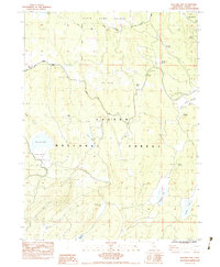
1983 Map of Bullard Lake
USGS Topo · Published 1983About this map
Lassen National Forest defines this high-elevation landscape in the early 1980s, characterized by a series of volcanic peaks and distinct water features. The map reveals an area managed for both natural preservation and utility, evidenced by the State Game Refuge in the north and various water sources like Pat Morris Spring and Ashurst Well. Small-scale infrastructure is present at Pat Morris Station and Camp Stanford, likely serving forest management or seasonal grazing activities common in this part of California.
Find a feature on this map
32 named features on this map. Tap any name to fly to it.
Don’t see what you’re looking for? This feature index may not catch every label — zoom into the map to look around manually.
Map Details
Editions of this 1983 Bullard Lake Map
This is the sole edition of this map. No revisions or reprints were ever made.
Other maps of this area

1886 · Honey Lake
USGS Topo · 1:250,000

1886 · Lassen Peak
USGS Topo · 1:250,000

1891 · Honey Lake
USGS Topo · 1:250,000

1892 · Lassen Peak
USGS Topo · 1:250,000

1893 · Honey Lake
USGS Topo · 1:250,000

1894 · Lassen Peak
USGS Topo · 1:250,000

1939 · Halls Flat
USGS Topo · 1:125,000

1955 · Westwood
USGS Topo · 1:250,000

1956 · Hayden Hill
USGS Topo · 1:62,500

1956 · Harvey Mtn
USGS Topo · 1:62,500