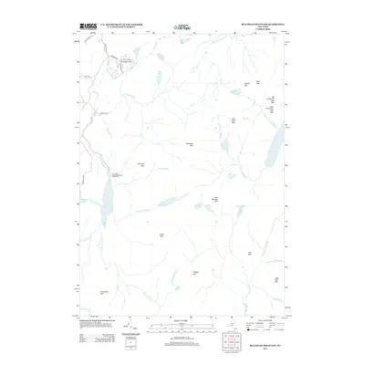
2013 Map of Bullhead Mountain
USGS Topo · Published 2013About this map
Bullhead Mtn and its surrounding peaks dominate this pocket of the Adirondacks, where the landscape is defined by high-elevation water bodies and steep ridges. The 2013 survey shows a backcountry environment punctuated by recreation-focused landmarks like Wilderness Lodge and the Thornbush Acres Recreational Vehicle Park. Significant water features such as Thirteenth Lake, Kings Flow, and Puffer Pond suggest a terrain where drainage patterns like Hour Pond Brook and the E Br Sacandaga River dictate the limited road network. Access is primarily restricted to the northwestern corner along Corscadden RD and Pratt RD, leaving the interior reaches, including Chimney Mtn and Peaked Mtn, as an undisturbed mountain wilderness with numerous small ponds such as Center Pond and Twin Ponds.
Find a feature on this map
49 named features on this map. Tap any name to fly to it.
Don’t see what you’re looking for? This feature index may not catch every label — zoom into the map to look around manually.
Map Details
Editions of this 2013 Bullhead Mountain Map
This is the sole edition of this map. No revisions or reprints were ever made.
Other maps of this area

1898 · Newcomb
USGS Topo · 1:62,500

1898 · Thirteenth Lake
USGS Topo · 1:62,500

1899 · Indian Lake
USGS Topo · 1:62,500

1901 · Newcomb
USGS Topo · 1:62,500

1902 · Indian Lake
USGS Topo · 1:62,500

1903 · Blue Mountain
USGS Topo · 1:62,500

1950 · Utica
USGS Topo · 1:250,000

1954 · Newcomb
USGS Topo · 1:62,500

1954 · Thirteenth Lake
USGS Topo · 1:62,500

1954 · Blue Mountain
USGS Topo · 1:62,500