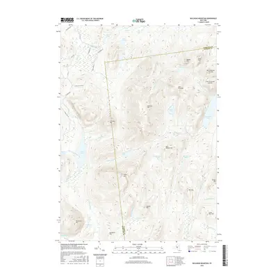
2016 Map of Bullhead Mountain
USGS Topo · Published 2016About this map
Thirteenth Lake and the surrounding high peaks of the Adirondacks dominate this 21st-century topographic survey. The landscape is defined by its complex drainage systems, where the E Br Sacandaga River and Kunjamuk River carve through a terrain marked by significant summits like Bullhead Mtn and Chimney Mountain. The map reveals a transition from managed waterways and reservoirs, such as Kings Flow and Buck Meadow Flow, to high-elevation water bodies including Peaked Mountain Pond and Hour Pond. While infrastructure is sparse, restricted mostly to the northwestern quadrant near Big Brook Rd and Chimney Mountain Rd, the detailed contouring provides a clear view of the mountain passes and marshes, including Robinson Swamp, that separate the Hamilton and Warren county lines.
Find a feature on this map
51 named features on this map. Tap any name to fly to it.
Don’t see what you’re looking for? This feature index may not catch every label — zoom into the map to look around manually.
Map Details
Editions of this 2016 Bullhead Mountain Map
This is the sole edition of this map. No revisions or reprints were ever made.
Other maps of this area

1898 · Newcomb
USGS Topo · 1:62,500

1898 · Thirteenth Lake
USGS Topo · 1:62,500

1899 · Indian Lake
USGS Topo · 1:62,500

1901 · Newcomb
USGS Topo · 1:62,500

1902 · Indian Lake
USGS Topo · 1:62,500

1903 · Blue Mountain
USGS Topo · 1:62,500

1950 · Utica
USGS Topo · 1:250,000

1954 · Newcomb
USGS Topo · 1:62,500

1954 · Thirteenth Lake
USGS Topo · 1:62,500

1954 · Blue Mountain
USGS Topo · 1:62,500