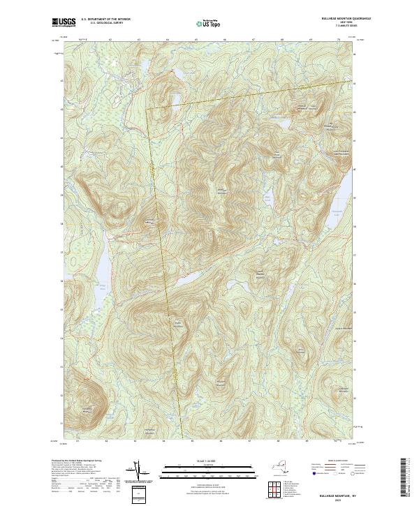
2023 Map of Bullhead Mountain
USGS Topo · Published 2023About this map
The boundary between Hamilton Co and Warren Co bisects a landscape defined by high peaks and an intricate network of backcountry trails. Central to this area is Bullhead Mountain, surrounded by a cluster of named summits including Chimney Mountain, Puffer Mountain, and Hour Pond Mountain. The drainage patterns are particularly complex here, with waters feeding the East Branch Sacandaga River to the southeast and the Kunjamuk River to the southwest.
Find a feature on this map
66 named features on this map. Tap any name to fly to it.
Don’t see what you’re looking for? This feature index may not catch every label — zoom into the map to look around manually.
Map Details
Editions of this 2023 Bullhead Mountain Map
This is the sole edition of this map. No revisions or reprints were ever made.
Other maps of this area

1898 · Newcomb
USGS Topo · 1:62,500

1898 · Thirteenth Lake
USGS Topo · 1:62,500

1899 · Indian Lake
USGS Topo · 1:62,500

1901 · Newcomb
USGS Topo · 1:62,500

1902 · Indian Lake
USGS Topo · 1:62,500

1903 · Blue Mountain
USGS Topo · 1:62,500

1950 · Utica
USGS Topo · 1:250,000

1954 · Newcomb
USGS Topo · 1:62,500

1954 · Thirteenth Lake
USGS Topo · 1:62,500

1954 · Blue Mountain
USGS Topo · 1:62,500