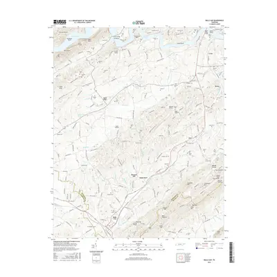
2016 Map of Bulls Gap
USGS Topo · Published 2016About this map
Bulls Gap serves as a central hub in this East Tennessee corridor, where the Norfolk Southern railroad intersects a landscape defined by the prominent Bays Mountain ridge. The map documents a dense network of family history markers, particularly numerous small burial grounds such as Guthrie Cem, Frank Berry Cem, and McBride Cem that dot the valleys and hillsides. The northern reach is shaped by the wide waters of Cherokee Lake and the Holston River, featuring distinct landmarks like Horseshoe Bend and Taylor Bluff. This 2016 survey illustrates the persistent rural character of settlements like Saint Clair, White Horn, and Otes, situated between the ridges of Nenny Ridge and Leading Ridge. The terrain is deeply partitioned by gaps and hollows, including Guthrie Gap and Jimtown Hollow, reflecting a historical geography where transport routes followed the natural breaks in the Appalachian folds.
Find a feature on this map
241 named features on this map. Tap any name to fly to it.
Don’t see what you’re looking for? This feature index may not catch every label — zoom into the map to look around manually.
Map Details
Editions of this 2016 Bulls Gap Map
This is the sole edition of this map. No revisions or reprints were ever made.
Other maps of this area

1883 · Morristown
USGS Topo · 1:125,000

1892 · Greeneville
USGS Topo · 1:125,000

1893 · Morristown
USGS Topo · 1:125,000

1895 · Morristown
USGS Topo · 1:125,000

1896 · Greeneville
USGS Topo · 1:125,000

1904 · Greeneville
USGS Topo · 1:125,000

1935 · Surgoinsville
USGS Topo · 1:48,000

1935 · Rogersville
USGS Topo · 1:48,000

1935 · Lee Valley
USGS Topo · 1:24,000

1935 · McCloud
USGS Topo · 1:24,000