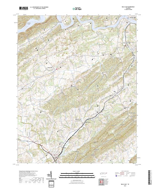
2022 Map of Bulls Gap
USGS Topo · Published 2022About this map
Bulls Gap serves as a critical junction where the Norfolk Southern rail line cuts through the gaps of Bays Mountain and Leading Ridge. This topographic study reveals a landscape defined by the parallel ridges of East Tennessee, with the Holston River and Cherokee Lake shaping the northern boundary. The density of family burial sites, such as McCullough Cem and Guthrie Cem, suggests a long history of established settlement in the valleys between River Knobs and Nenny Ridge. Local social life is anchored by traditional landmarks like Saint Clair Sch and Morrisett Chapel. The mapping of small water bodies like Heck Pond and Cantrell Pond alongside numerous creeks, including War Creek and Robertson Creek, illustrates the complex drainage patterns of the Grassy Valley region.
Find a feature on this map
214 named features on this map. Tap any name to fly to it.
Don’t see what you’re looking for? This feature index may not catch every label — zoom into the map to look around manually.
Map Details
Editions of this 2022 Bulls Gap Map
This is the sole edition of this map. No revisions or reprints were ever made.
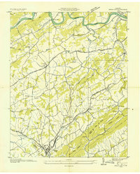
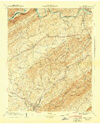
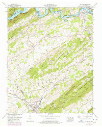
Historical Maps of Austins Mill Through Time
4 maps found