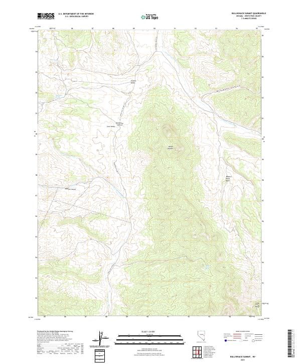
2021 Map of Bullwhack Summit
USGS Topo · Published 2021About this map
Bullwhack Summit stands as a central topographic marker in this high-elevation corner of White Pine County, where the southern reaches of the Steptoe Valley transition into the Cave Valley. The landscape is defined by its drainage patterns and prominent summits, featuring the curiously named Mollys Nipples and the rugged eastern flank of the Schell Creek Range. These mountain corridors were vital to early Nevada travel and ranching, evidenced by numerous water sources such as Jones Spring and Bullwhack Spring.
Find a feature on this map
21 named features on this map. Tap any name to fly to it.
Don’t see what you’re looking for? This feature index may not catch every label — zoom into the map to look around manually.
Map Details
Editions of this 2021 Bullwhack Summit Map
This is the sole edition of this map. No revisions or reprints were ever made.
Other maps of this area

1956 · Lund
USGS Topo · 1:250,000

1960 · Lund
USGS Topo · 1:250,000

1969 · Parker Station
USGS Topo · 1:24,000

1969 · Haggerty Spring
USGS Topo · 1:24,000
1973 · White Rock Creek
USGS Topo · 1:24,000

1973 · Cattle Camp Spring
USGS Topo · 1:24,000
1973 · Horse Camp Springs
USGS Topo · 1:24,000
1977 · Bullwhack Summit
USGS Topo · 1:24,000
1977 · Brown Knoll
USGS Topo · 1:24,000
1977 · Sawmill Canyon
USGS Topo · 1:24,000