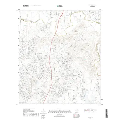
2019 Map of Bulverde
USGS Topo · Published 2019About this map
Cibolo Cr and its tributaries carve through the limestone landscape of the Texas Hill Country along the border of Comal and Bexar Counties. This modern survey captures the transition from rural ranching roots to residential expansion north of San Antonio. The map is particularly rich in family history markers, noting numerous private burial grounds including Schlather Cem, Voges Cem, and Peña Cem that dot the hillsides. While suburban developments like Timberwood Park dominate the western portion of the sheet, the northern reaches maintain a more open character around Bulverde and the Bulverde Airpark. Prominent elevations such as Vogels Peak and Classen Hill provide landmarks between the winding courses of Elm Waterhole Cr and Mustang Cr. The presence of springs like Cherry Spring and Walnut Spring highlights the importance of groundwater in this semi-arid terrain.
Find a feature on this map
307 named features on this map. Tap any name to fly to it.
Don’t see what you’re looking for? This feature index may not catch every label — zoom into the map to look around manually.
Map Details
Editions of this 2019 Bulverde Map
This is the sole edition of this map. No revisions or reprints were ever made.
Other maps of this area

1920 · Smithsons Valley
USGS Topo · 1:62,500

1927 · Smithson Valley
USGS Topo · 1:62,500

1929 · Smithson Valley
USGS Topo · 1:62,500

1940 · Smithson Valley
USGS Topo · 1:62,500

1953 · Otis Ridge
USGS Topo · 1:24,000

1953 · Schertz
USGS Topo · 1:24,000

1953 · Bulverde
USGS Topo · 1:24,000

1953 · Bat Cave
USGS Topo · 1:24,000

1953 · Longhorn
USGS Topo · 1:24,000

1953 · Castle Hills
USGS Topo · 1:24,000